#742 Beyond the Great Western Peninsula
ESSAY: Beyond the Great Western Peninsula
by Richard Mackie
*
I received a doctorate in Canadian history at UBC in 1993 and taught as a sessional lecturer at three colleges or universities on Vancouver Island between 1994 and 2002.[1] To the uninitiated, Canadian history is divided in half, into “pre-Confederation” and “post-Confederation,” shortened to “pre-confed” and “post-confed.” Altogether I taught pre-confed five times. Typically, I would be contacted by a department chair in August, or even early September, and asked to take the place of a faculty member who had unexpectedly gone on leave (usually parental or medical), got a tenure-track job at another university, or received a course release due to a grant. “You would be surprised by the number of ways my colleagues have to get out of teaching,” remarked one exasperated department chair.
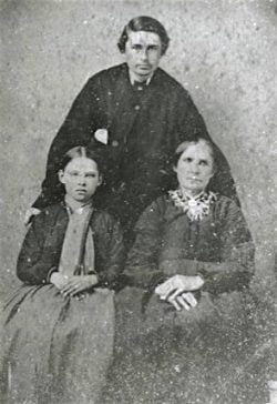
By late August, the course textbook had been long ordered and I had no choice in the matter. My spirits would flag when I looked at the textbook and found the meagre fare offered on the Canadian fur trade and early British Columbia. In the mid-1990s I was revising my dissertation on the commercial history of the North West Company (NWC) and Hudson’s Bay Company (HBC) west of the Rocky Mountains into a book, Trading Beyond the Mountains, published by UBC Press in 1997, along with a related series of six biographies of west coast fur traders that appeared in volumes 12 and 13 of the Dictionary of Canadian Biography, including the life of Joseph William McKay (1829-1900, pictured right). [2]
I struggled to accept the lack of textbook coverage accorded to places west of Ontario. Two centuries of fur trade activity were usually lumped into one or two chapters in the textbooks. This included the Indigenous responses to the fur trade in Rupert’s Land and west of the Rockies and the histories of colonial Red River, the western cordillera, colonial Vancouver Island, and colonial British Columbia. It was not for lack of writing: for a start, the many volumes of the Hudson’s Bay Record Society (HBRS) and the Champlain Society had produced an impressive – if somewhat undigested — foundation for scholars of Canada beyond the St. Lawrence. Typically, of course, the other textbook chapters dealt in depth with the older parts of settled Canada.[3] The settler population of western Canada was too low, and the date of colonial settlement too late, to warrant more coverage. After all, Confederation was in 1867, and Canada did not purchase Rupert’s Land from the HBC until 1869, and the thinking seemed to be that HBC history was somehow anterior and peripheral to the proper settler history of Canada.
Given my interests and expertise, I saw this coverage as spatially biased, conceptually antiquated, and regionally insufficient. In fact, three pre-confederation colonies existed west of the Great Lakes in the 1860s — Red River (1811), Vancouver Island (1849), and British Columbia (1858) — and in my view each deserved a chapter in a pre-confederation textbook. Instead, the textbooks provided multiple chapters on the March to Responsible Government and the Road to Confederation, political topics that privileged a centralist narrative and tended to view the western parts of Canada as irrelevant or marginal add-ons or afterthoughts to the expansionist federal project, regional sidebars added to the Central Canadian arc for the sake of telling “the complete story.” As a western Canadian fur trade scholar this was simply wrong; and if I adhered to the textbook, my students would get a very large helping of the political history of what the poet bill bissett calls “Centralia,”[4] and almost no western Canadian or B.C. history. I sensed a massive proprietary assumption at the basis of Canadian nationhood and in subsequent writing. What passed for a national metanarrative was, in fact, every bit as regional as the Laurentian (Canadian Shield) paintings of the Group of Seven or the west coast temperate rainforest canvases of Emily Carr. The places in Alberta and British Columbia where I was born, grew up, and educated were largely absent.

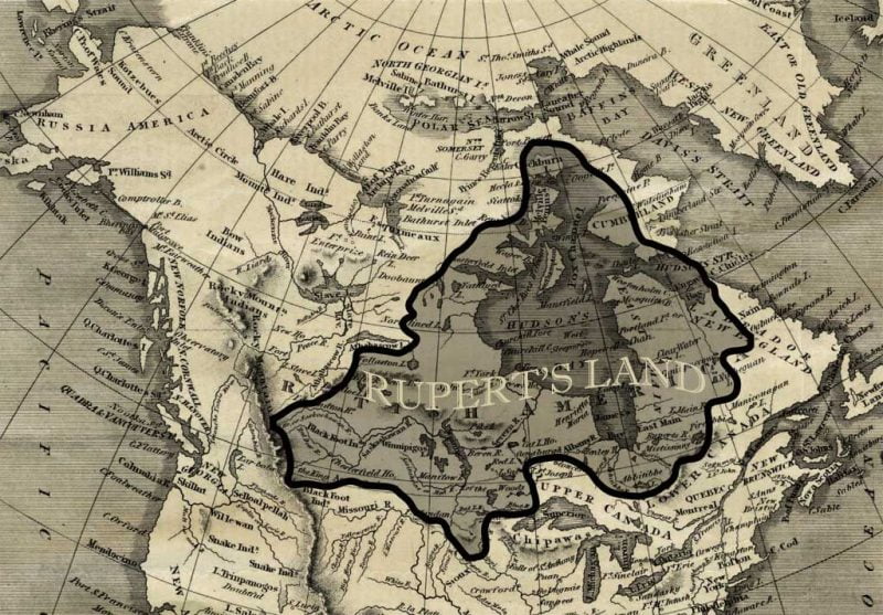
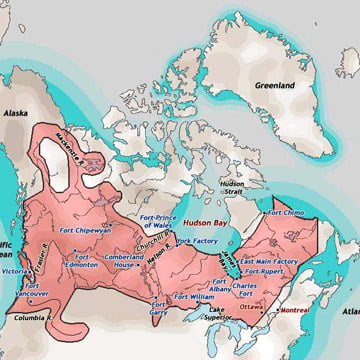
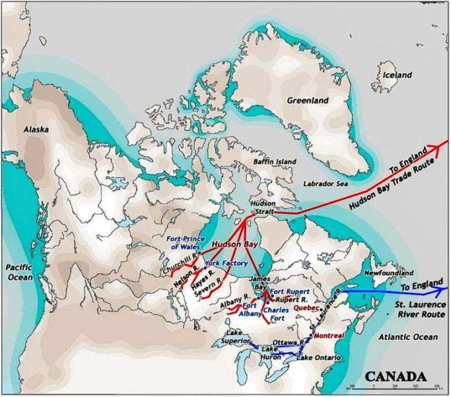
As a scholar of the fur trade in its continental heyday, between 1820 and 1870, I was acutely aware of the fur trade’s regional nature. In the 1820s, following its merger with the NWC, the HBC divided its operations into four large departments — Montreal, Northern, Southern, and Columbia — each with its own shipping port or, in fur trade parlance, depot (Lachine, York Factory, Moose Factory, and Fort Vancouver), each in direct contact with the HBC’s London headquarters and with separate interior districts and departmental and continental transport routes. Each department was large enough, fur trader Alexander Ross recalled, “for the territory of a crowned head.”[5]
My own scholarly focus was the Pacific coast, but I knew that the other three HBC departments also provided enough archival documentation for regional monographs on a range of economic, social, and political topics from the post (fort), district, and departmental levels. My assigned textbook, Origins: Canadian History to Confederation contained none of this. My own work on the Columbia Department was of a regional nature, as was the work, for example, of scholars of Labrador, Red River, or Mackenzie River, or anywhere else in what was called “fur trade territory,” and I knew that the existing scholarly writings on the HBC’s regions in the nineteenth century alone could provide the raw material for large and substantial chapters in those same pre-confederation textbooks: for example, chapters on Rupert’s Land to 1870; Red River Settlement to 1870; Indigenous culture change and responses east of the Rockies; the Columbia and Cordilleran fur trades to 1849; the HBC’s colony on Vancouver Island to 1858; Indigenous culture change and responses west of the Rockies; the commercial role of the HBC on colonial Vancouver Island and British Columbia in the gold rush era, 1858-1871. The most stirring events of 19th century Canadian history, the Fraser River and Cariboo gold rushes of 1858-68, received barely a mention. All these topics are legitimate pre-confederation history and had attracted the attention of able scholars by the 1990s.
In short, I found that my own research and published writing did not seem to fit into the centralist narrative of pre-confederation Canadian history textbooks. My solution, as with lecturers everywhere, was to use the textbooks selectively and supplement them with readings and material of my own choice. But when I was parachuted into a course at the eleventh hour, I had little or no time to make formal changes to the syllabus. On one occasion I used someone else’s syllabus with her name crossed out and mine added in pen at the last minute by the departmental secretary. I cared about all this, both for the sake of my own historical interests and cultural identity and for the sake of my students. Increasingly, for my Canadian survey courses I fell back on the elegant and informative plates of the three volumes of the Historical Atlas of Canada, published between 1987 and 1993 — but as I did so, I noted that the volumes contained only two maps each devoted exclusively to British Columba: six plates out of a total of 193.[6]
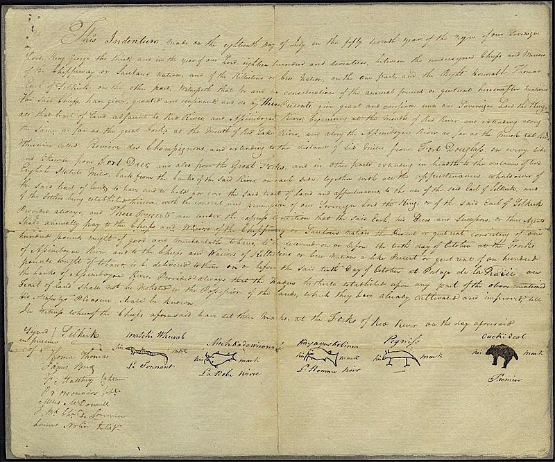
This essay aims to explore the origins of a bias in the writing of “national” English Canadian history in the nineteenth century, especially its focus on central Canada and its neglect of the departments, districts, posts, and economy of the fur trade between Labrador and Vancouver Island, and of the colonies (now provinces) that emerged from them in the pre-confederation era. What was known as “fur trade territory” comprised most of British North America. Much of this area, of course, was still formally unceded Indigenous land; the first treaties anywhere west of Upper Canada were signed at Red River in 1817 (“Lord Selkirk’s Treaty with the Indians” of 1817) and the Fort Victoria Treaties (or Douglas Treaties) on Vancouver Island between 1850 and 1854.[7]
But there was more going on than a curious neglect of large regions of Canada and their rich histories and historiographies. At the same time as the centralist narrative skated quickly over or omitted the transcontinental sweep of the 19th century fur trade, it privileged the early history of Quebec and especially Ontario. To explore this imbalance, I will venture first into the early history of Upper Canada before I return to Canadian fur trade history. I will compare the foundational narratives and maps and the territories they present: Upper Canada in the early and mid nineteenth century and the fur trade departments and districts at the same time. I will resurrect the nineteenth century term “Great Western Peninsula” to characterize the part of Canada now known as southern Ontario. I will emphasize early Ontario’s intensely circumscribed early history, its static, landlocked, and deeply regional nature, and its lack of connection with its own outlier settlements further west. I then discuss the expansive continental operations of the HBC and suggest that they, and the productive work of western fur trade scholars, provide both a remarkable territorial extension and a legitimate intellectual tradition that deserve more space in those pre-confederation textbooks.
*
What we now call southern Ontario originated as part of the les pays d’en-haut (Upper Country, or western rural region) of New France, which with its military defeat in 1760 passed to Britain.[8] The pays d’en-haut was designated part of the “Indian Territory” under the Royal Proclamation of 1763; in 1774 it became part of the western portion of the new and enlarged Province (Colony) of Quebec; and after 1783, western Quebec saw an influx of English-speaking Loyalists from the United States. Land was available, but Quebec’s institutional structure was not to the Loyalist settlers’ liking. They were unwilling to accept Quebec’s system of French civil law or its seigneurial system, and preferred their familiar institutions of freehold land tenure, English common law, and Protestant churches.[9]
The government of Quebec therefore allowed the Loyalists to settle and form their familiar institutions in the pays d’en haut. Loyalists received free land grants of 200 acres in the 1780s.[10] Some 5,000 of them settled along the banks of the St. Lawrence between Lake Saint-François and Lake Ontario, as well as on the north shore of Lake Ontario, the Niagara Peninsula, and along the Detroit River. This was the start of what we now call Ontario.
In 1791, to recognize that two societies now occupied the territory of Quebec, the British government divided Quebec into two new provinces, Lower Canada and Upper Canada, separated by the Ottawa River and named for their physical position on the St Lawrence River. Territorially, les pays d’en haut became Upper Canada. Each province, Cole Harris notes, had different provisions for law, language, and religion.[11] Rooted in the landed ambitions of the Loyalists, the settlement of Upper Canada was made possible by a comprehensive series of agreements with Indigenous people signed between 1764 and 1836, when some twenty treaties made the whole of southern Ontario available for colonial settlement. The slightly later Robinson-Huron and Robinson-Superior treaties (nos. 60 and 61), which covered the north shores of Georgian Bay and Lake Superior, were signed in 1850.[12]
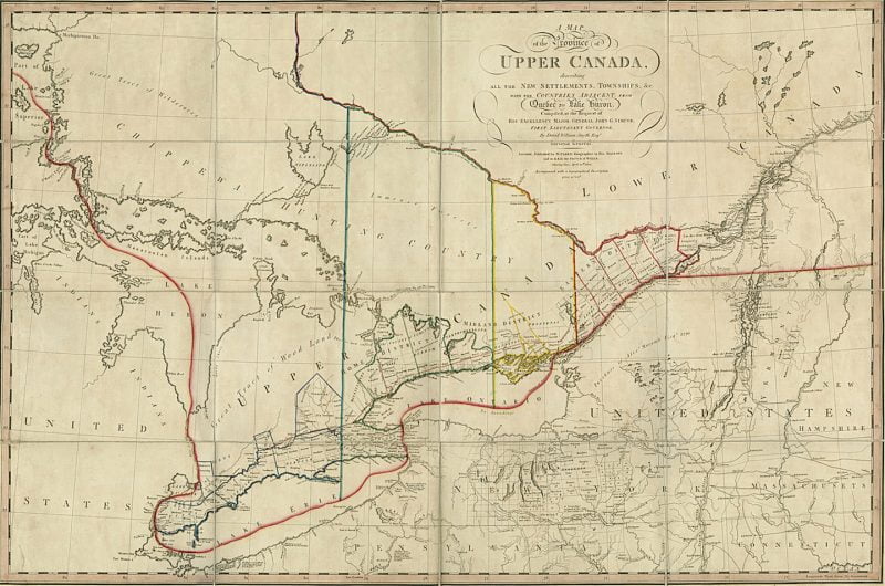
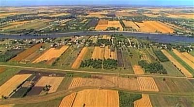
A map of Upper Canada of 1800 by David Smyth shows a strip of settlement in the form of districts and counties along the north shore of the St. Lawrence, Lake Ontario, and Lake Erie. The economy here would be focussed on wheat. But shoreline and lake settlement was only a start: on the Smyth map, the northern half of the Upper Canada was still marked Great Tract of Wood Land, beyond which – unmarked, unacknowledged, and irrelevant to the map — is the venerable western route of the Montreal fur traders from the Ottawa River to Lake Nipissing and Georgian Bay. The territory beyond Georgian Bay and Lake Nipissing is marked Chipewa Hunting Country, and beyond that, on the north shore of Lake Superior, is Great Tract of Wilderness.[13] In short, Upper Canadian settlements were well to the south of the main east-west artery of the Montreal fur trade, and land beyond those settlements was considered either wilderness or Indigenous land.
Upper Canada’s isolation resulted from political, legal, and geographical factors. Upper Canadian settlement was constrained by the Great Lakes and the Canadian Shield; and, to the north and west, by the legal existence and commercial economy of Rupert’s Land. In the north, Upper Canada ran into the pervasive, exposed, and sterile pre-Cambrian (“Canadian”) Shield, which cut across the peninsula from Georgian Bay in the west, roughly at the 45th latitude, to between Kingston and Brockville in the east. All the early settlement of Upper Canada took place to the south of this formidable barrier to agriculture, and specifically in the St. Lawrence Lowlands between the 42nd and 45th latitudes. To the north, Upper Canada’s territory comprised only the land that drained south into lakes Huron and Superior and into the Ottawa River. That is, Upper Canada’s northern border stretched only to the watershed of Hudson Bay, which had been the commercial territory of the HBC’s Rupert’s Land since 1670.[14]
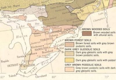
Therefore the territory of Upper Canada comprised two main regions: a barren and sterile region to the north and west, dominated by the Shield and unfit for agriculture; and to the south, a fertile and productive peninsula with water access to the St. Lawrence and Atlantic Ocean. Upper Canada’s ecological regions reflect the north-south divide. The watershed between Hudson Bay and the Great Lakes-St. Lawrence lowlands marked the approximate line between the Eastern and Continental Boreal Provinces and the Great Lakes St. Lawrence Forest Province. The whole of what is now southern Ontario is within two ecological regions (ecoregions): the Deciduous Forest Province, typified by Beech-Maple forests and soils of grey-brown luvisol and humic gleysol; and the Great Lakes-St. Lawrence Forest Province, typified by a Maple-Hemlock forest and soils of humic-ferric podzol, grey-brown, and grey luvisols.[15] Most of Ontario’s southern peninsula consisted of “grey-brown podzolic soils with dark grey gleisic soils” or “grey-brown luvisol” — which translates as good farmland.[16]
Therefore the physical constraints of its setting restricted Upper Canadian settlement to a temperate and generally fertile peninsula, well south of the 49th parallel, checked by the Shield and by Lake Huron and Georgian Bay to the north; by Lake Ontario and Lake Erie to the south; and occasionally bordering on contiguous American territory — along the upper St. Lawrence, at Niagara, and at the Detroit and St. Clair rivers in the west. To the north, the Canadian Shield ran the entire length of the shores of lakes Superior and Huron.
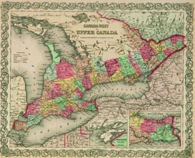
The first colonized part of Upper Canada was known to contemporaries as the “Great Western Peninsula” — the peninsula surrounded by Lakes Ontario, Erie, and Huron, and blocked by the Shield in the north. It received its name because the first Loyalists settled on eastern Lake Ontario in the vicinity of Kingston and on the upper St Lawrence River. The abundant peninsula was to the west of these early settlements. When early Upper Canadians spoke about “the west,” they meant their own immediate and accessible western peninsula.
This heartland of settlement in Upper Canada is now approximately southern Ontario. A considerable agricultural opportunity existed here and the pace of settlement was vigorous. The shores of lakes Ontario and Erie were surveyed and occupied first after 1783.[17] The population of Upper Canada increased from 6,000 in 1785, to 25,000 in 1796, to 60,000 in 1811, to 150,000 in 1824, and 375,000 in 1846.[18] Most of this increase was absorbed by the Great Western Peninsula.
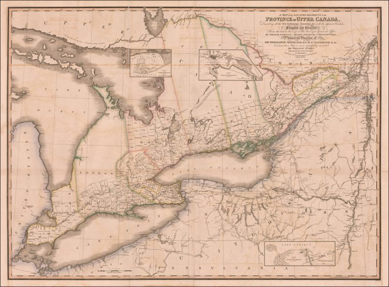
A map of Upper Canada, published in London in three different editions between 1825 and 1827, and largely the aggregate work of surveyor and cartographer James Chewett, shows a range of counties, townships, towns, roads, and rivers. It is described by historian of cartography Joan Winearls as “one of the most important maps to be published in the first half of the century.” It was, Winearls notes, “the most accurate map of the province until the late 1850s.”[19] Most settlements on this map are clustered along the St Lawrence River, along the north shore of Lake Ontario, the north shore of Lake Erie, and on the Niagara Peninsula. Eleven counties are named (Ottawa, Eastern, Bathurst, Johnstown, Midland, Newcastle, Home, Gore, Niagara, London, and Western), within which are a great number of townships. The northern boundaries of these counties meet Georgian Bay or Lake Huron or dissolve into an apparent wilderness.[20]
In 1826, everywhere between the Ottawa River and Detroit River, French and Indigenous names alike were expunged and overlain by a remorseless progression of nostalgic English settler-colonial place names, from Gloucester to Gosfield to Grimsthorpe and towns with names like York, Bath, and Windsor. Only around the edges of the settled heartland of Upper Canada did French place names persist on this 1826 map: Sault de la Chaudière, Lac de la Chaudière, Sault du Chat, and Lac du Chat on the Ottawa River; Rapide Plat on the St Lawrence; and another ten French place names, from Portage de la Chaudière to Sault du Récollet, on the French River between Lake Nipissing and Lake Huron. French place names had the best chance of survival where they were still occupied or used by Montreal-based fur traders, such as on the Ottawa River and the aptly-named French River.
*

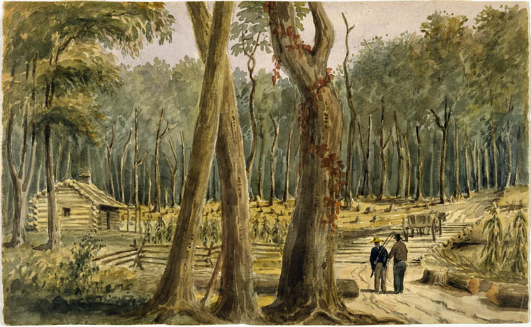
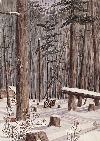
If a single theme dominates early Upper Canadian history it is land clearing and settlement, a reminder that Upper Canada’s frontier was an expanding perimeter of land-clearing and wheat cultivation.[21] A map of “cleared land” in 1842 shows the agricultural ecumene bumping up against the Canadian Shield – the boundaries of which were first determined (by Sir John Richardson) in 1851.[22] A wheat belt ran through the colony, and in that year, wheat production was highest in the southern parts of the peninsula.[23]
Early Upper Canadian history is largely about agricultural settlement.[24] As Gentlicore notes, “Flat land, good soils, a long growing season, and adequate rainfall added up the most attractive physical base for agriculture in British North America.”[25] One example will suffice. In The Soil Survey of Victoria County (east of Lake Simcoe), Gillespie and Richards (1957) noted that, “The Brighton soils are cleared and used fairly extensively for agricultural purposes. Such crops as fall wheat, rye, oats, corn, timothy, clover and alfalfa are being grown. In the southern part of the County such specialized crops as potatoes, tomatoes and small fruits are also grown.”[26] Such fertility and productivity was impossible further north.
Surveyed lots along the St. Lawrence and Niagara Rivers, and on Lakes Ontario and Erie, were taken up first and, after 1791, military streets (Yonge and Dundas) and “Colonization Roads” in the 1840s and 1850s reached out into the agricultural land of the Great Western Peninsula, where a vast stretch of cultivable land was made available to immigrants.[27] Herman Merivale, in his Lectures on Colonization and Colonies (1842), noted that about seventeen million acres of potential farmland in Upper Canada had been surveyed to 1825, “a surface as great as Ireland,” of which three million acres had gone to Loyalists.[28] David Wood et al. summarize these early years:
The availability of a large expanse of good land, the opportunity to reach and serve a buoyant international market for wheat, and the influx of large numbers of land-hungry immigrants, many with capital, hastened development. Land clearing was rapid, a cash wheat economy was pervasive, and a service network of mills, markets, and artisans centred in small towns, was set in place.[29]

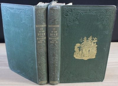
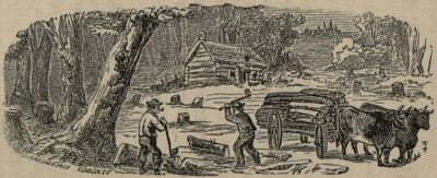
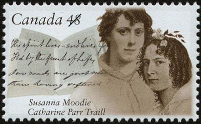
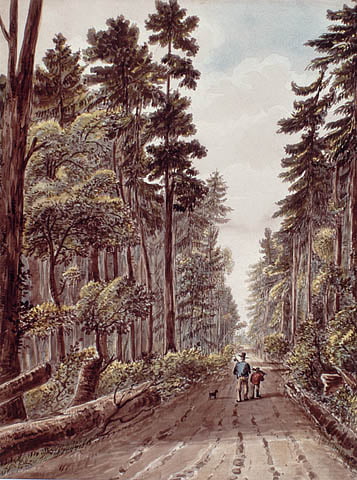
The Great Western Peninsula is the territory of Catherine Parr Traill’s The Backwoods of Canada (1836), and her sister Susanna Moodie’s memoir Roughing it in the Bush (1852), both of them set near Peterborough. Their backstory is the British agricultural settlement of the Great Western Peninsula. Their stories capture the settler engagement with land clearing and bush farming in this part of Canada.
The terms Western Peninsula and Great Western Peninsula pervade contemporary documents and publications. For example, in 1856 the Commissioner of Crown Lands wrote that, “The important fact, therefore, now strongly presents itself, that, in the great western Peninsula of Upper Canada, which has hitherto been the chief receptacle of immigration to the Province, the supply of Crown lands for settlement is now exhausted….”[30] The richest agricultural districts of the Great Western Peninsula had been cleared and occupied, and by 1851, “the agricultural settlement of the Great Western Peninsula ran up against the Canadian Shield,” just as “the last corners of the province, towards Georgian Bay and up the Ottawa Valley, were being surveyed for settlement.”[31]
The peninsula offered an impressive infrastructure and appeal to immigrants and commerce. The aptly-named Great Western Railway ran its length from Niagara Falls to Windsor, and by 1855 it also connected with Toronto, Hamilton, and London. The major cities in 1851 were Toronto (population 30,000), Kingston (11,700), Hamilton (14,000), Ottawa (7,800), and London (7,000).[32] Upper Canada’s great strength was its wheat economy and its access to the St. Lawrence commercial system. Primary markets for wheat were Britain, Lower Canada, and the Atlantic colonies.[33] Gristmill capacity, for flour for colonial use and export, increased enormously between 1825 and 1850.[34]
In the 1826 map, settlement was still clustered and focussed on the upper St. Lawrence. The key to Upper Canada’s commercial power was its position on and access to the St. Lawrence, an advantage it inherited from its actual origin as the western and inland portion of Quebec. Facilitating east-west transport from the Great Lakes and commerce with the Atlantic were the Lachine Canal in Montreal (opened 1825), the Welland Canal between Lakes Erie and Ontario (opened 1829), and the Rideau Canal (opened 1832), linking Ottawa and Kingston and the Ottawa River with Lake Ontario and avoiding the strategically vulnerable St. Lawrence between and Kingston and Cornwall. All were components of what McKillop calls the “Laurentian waterway.”[35]
The settled districts ran only as far north as the Canadian Shield. Numerous colourful and boosterish maps of Canada West in the 1850s and 1860s, available in a web search, show the crowning achievement of the colony: a fully-surveyed and occupied Great Western Peninsula. Between 1851 and 1891, this region, writes Grant Head, “lying between Lakes Ontario, Erie, and Huron, yielded nearly half of the country’s field crop and animal production, feeding its own and other parts of the country and sending much produce to markets abroad, largely in the United Kingdom.”[36]
*

Surrounded by the Great Lakes and the Canadian Shield, the Great Western Peninsula was a bounded space and an anomaly in British North America: a large stretch of agricultural land where, as Cole Harris puts it, “The landed opportunity soon ran out.” In 1800, the pockets of good farmland in the dispersed colonies of British North America — the Bay of Fundy, St. John River valley, the south shore of Gulf of St Lawrence, the St. Lawrence River valley, and Southern Ontario — were “worked out near or beyond the continental limit of agriculture.”[37] As Harris notes of the British North American colonies in 1800, “Farming took place fairly close to the climatic margin on land that was bounded, rarely far away, by rock and soils that could not be cultivated.”[38]
The substantial tract of agricultural land and settlement between the eastern Great Lakes and the southern edge of the Canadian Shield provided a rare opportunity for rural stability and permanence. Upper Canada was a colony devoted to agriculture, one of the few places in British North America where farming became an expansive and sustaining activity. The extent and draw of fertile land and agricultural settlement on this peninsula was a rarity in Canadian history, matched only, a century later, by the Prairie settlements of the CPR era, 1880s-1914.
Apart from a sizeable lumber trade with the US, mainly from the Ottawa River,[39] the external emphasis and trade of Upper Canada was eastward. Before the completion of the CPR, the aptly-named Laurentian vision of the Canadian colonies ran into Lake Huron and could reach no further west.[40] The larger west of British North America did not figure in Upper Canada’s history, psyche, or economy. Upper Canada had no connection to the fur trades of either Montreal or Hudson Bay. The London and Montreal-based fur trades did not provide Upper Canada with access, commerce, frontier, identity, territory, or western ambitions.

*
Before the 1860s, then, Upper Canada was asleep between three frozen lakes, preoccupied with its peninsular location, focussed internally on land clearing and agricultural settlement and production, and removed from the Great Lakes and Canadian Shield by its own remote or inclement western and northern frontiers. It had, perhaps, enough to keep busy with, but in continental terms it was static. While it was impressively fertile and productive, the Great Western Peninsula was insular, peninsular, and lake-locked. It was also, like most colonies in British North America, a profoundly regional creation.[41] Upper Canada’s heartland was hemmed in by the Great Lakes, the Canadian Shield, and Rupert’s Land — three specific obstacles to settlement and expansion shared by no other part of British North America.
For much of the pre-confederation period, Upper Canada was also busy with its internal political processes, as those pre-confederation textbooks made abundantly clear. Its well-developed political culture with active Tory and reformist factions culminated in the 1837 rebellion. It was dominated by a colonial elite, the Family Compact. It was preoccupied with the March to Responsible Government, a process that occupies entire chapters of the introductory textbooks. This political process culminated in the Act of Union of 1841, a template for colonial federation for Upper and Lower Canada that, in turn, provided the prototype and momentum for the Road to Confederation. By the 1840s, the Canadian colonies possessed a political maturity unmatched elsewhere in British North America. The valuable political lesson was that if these two distinct colonial societies could join within a single parliament and assume the common name Canada, so could others.

Upper Canada’s political and nation-building narrative is nonetheless deeply regional. So strong was its focus on the soil potential of its agricultural heartland that any interest in the province’s own westernmost territories was an afterthought right up until confederation. And there were good reasons for this. The sterile Canadian Shield ran the entire length of the northern shores of Lakes Huron and Superior, rendering access difficult. As late as 1852, no road had been built to the eastern end of Lake Superior. The only connection was an infrequent boat service to Sault Ste. Marie.[42] Most pre-Confederation maps of Ontario do not even bother to show Lake Superior. Chewett’s map of 1865 displays no roads along Georgian Bay.[43] As late as 1874, when Governor-General Dufferin visited Port Arthur and Fort William at the west end of Lake Superior, he did so by steamer.[44] Pre-confederation maps of Ontario rarely even show the west end of Lake Huron. Their focus is always the heartland of the Great Western Peninsula.
And this was not just a bias of the mid 19th century. The Ontario base map in volume 2 (19th century) of the Historical Atlas of Canada, produced in the 1990s, omits Lake Superior altogether. The stirring settler activity was on the Great Western Peninsula. The westernmost point on the HAC base map is Sault Ste. Marie. For analytical purposes, Ontario ends somewhere in Georgian Bay.[45] Ontario would not be connected by land to its western extremities until 1885, when the CPR from Montreal and Sudbury reached Port Arthur and Fort William. (The stretch of CPR mainline from Port Arthur to Winnipeg had been completed earlier, in 1883.) [46] Indeed, right up until 1899, the official maps of Ontario land districts extend only as far as Manitoulin Island and the west end of Georgian Bay.[47] No wagon road was ever built to the west end of Lake Superior.[48] A motor road to western Ontario was not completed until 1942, a century and a half after the formation of Upper Canada, when the first road link across northern Ontario to the west end of Lake Superior was finally completed.[49] These are hardly the signs of a society with a lively interest in its own western territory or equipped to accommodate or embrace the territories acquired by the purchase of Rupert’s Land.
The term Great Western Peninsula went out of use in the 1860s or 1870s. By this time “western” peninsula was a misnomer. When Ontario awarded itself a vast west following Canada’s purchase of Rupert’s Land in 1869, the name Great Western Peninsula disappeared — though the seemingly incongruous founding of “The Western University of London, Ontario” in 1878 reflected the earlier usage: London is now a two-hour drive from Toronto. Indeed, what had been “west” in Upper Canada gradually became eastern Ontario. Having absorbed a large part of Rupert’s Land, Ontario soon extended so far west that the Great Western Peninsula could with greater accuracy be called the Great Eastern Peninsula. Eventually, with Ontario’s unprecedented territorial expansion north and west, the compass would need to be reset again, and the Great Western Peninsula would be renamed Southern Ontario.
By 1867, therefore, firmly rooted in its agricultural heartland but always constrained by the Great Lakes and Canadian Shield, the settled parts of Ontario barely reached Lake Superior. At first, the new province had little interest in or awareness of its own west and north. For example, a map showing the federal ridings of Ontario of 1872 ends at the southern edge of the Canadian Shield.[50] Fort William, at the west end of Lake Superior, was still within the HBC’s commercial sphere, far removed from the rural settlements of the fertile southern peninsula. Ontario’s momentum of settlement had been spent on the heartland of the Great Western Peninsula. It had been channelled into the important task at hand. Meaningful settlement did not extend beyond clearing and occupying that peninsula. So powerful was the agrarian ethos that the bulk of the province’s territory was excluded cartographically.
Ontario’s emphasis and energy had gone into an accessible and fertile peninsula, into dispossessing First Nations there, into building extended “streets” and Colonization roads, and into clearing land and starting farms. It was an impressive settler achievement — but it was highly localized and hemmed in by the Great Lakes and Canadian Shield. Indeed, prior to the completion of the CPR, and with its best farmland taken up by 1850 and with no accessible west of its own, Ontario witnessed a large-scale exodus of population to the United States. The colony’s surplus population had nowhere to go in British North America, and beginning in the mid nineteenth century, hemmed in by the Great Lakes and Canadian Shield, the surplus population of Canada West (and Canada East) started haemorrhaging south.[51] In a process known as “The Exodus,” notes the Historical Atlas of Canada, “Rural Ontario lost young men to Detroit or Chicago, or to the agricultural and lumbering frontiers in the western United States.”[52]

*
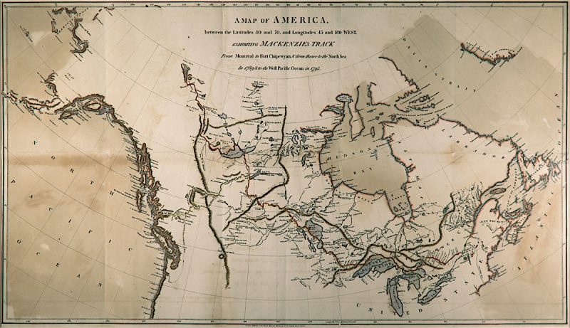
Meanwhile, those parts of British North America to the north and west of Ontario evolved independently and in equal isolation. Arrowsmith’s map of the territories of the HBC in 1830, for example, reveals the extension of the fur trade into the more westerly portions of British North America a decade after the merger of the NWC and HBC in 1821. It also reveals the complete absence of historical or economic connections between Upper Canada and the HBC territories.
Arrowsmith’s map of 1830 is not a map of Canada. It is a map of active fur trade districts and departments of the HBC, some of them with a European history older than the colonial settlements in Upper Canada. With the 1821 merger, the new HBC retained two sites of genesis, two points of origin. The first was the crucible of the St. Lawrence, the western commercial frontier of which the NWC had extended to the Pacific Ocean in 1793. The second was the crucible of Hudson Bay, with its interior access to Rupert’s Land and its seaboard access to the London fur market. These were merged in 1821 into a fur trade behemoth that occupied much of a continent and thwarted, for example, repeated attempts by American fur traders to oppose it anywhere west of the Rockies and on the Pacific coast.[53]
The HBC grappled with the governance and economy of half a continent while Upper Canada, in its insular and lake-locked colony well south of the 49th parallel, grappled with a fertile peninsula and responsible government for its settler population. While the total area of the Great Western Peninsula is some 137,000 square kilometres, the area shown in Arrowsmith’s map of 1830 is nearly 10,000,000 square kilometres – a working territory almost seventy-three times as large.[54] The territory legally controlled by the HBC between 1821 and 1869 by charter, statute, licence, and various agreements would become the second-largest nation state in the world.[55]
While Upper Canada in the first half of the 19th century was static and preoccupied with its farming frontier, commercial economy, and internal politics, after 1821 the HBC was expansive and continental in scope and ambition. Driven by the engine of its demand for peltries — animal pelts were the only commodity light and valuable enough for canoe transport and portaging — the HBC expanded its commercial and administrative structure across much of what became Canada, a process known to fur traders modestly as “extending the trade.”[56] In their quiet but effective way, they extended the trade to create the map of modern Canada. The HBC possessed a formidable spatial momentum, an impressive and elastic commercial character, and connections and financial resources in the City of London inherited from the pre-merger HBC. It also inherited the NWC’s personnel connections in Montreal; it continued to hire there until the 1860s.[57]
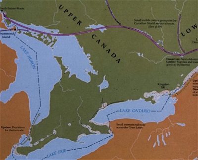
The HBC operated far north and west of the southern agricultural base of Upper Canada, which had, in turn, no meaningful presence anywhere in the HBC’s territories prior to Canada’s purchase of Rupert’s Land in 1869, and no interest or stake in the fur trade.[58] The HBC’s main continental transport routes after 1821 bypassed the settled districts of Upper Canada, which were far to the south. The venerable main line of the Montreal fur trade led from the St. Lawrence River just west of Montreal, and then up the Ottawa River and through the Canadian Shield to Lake Nipissing and to Georgian Bay. Upper Canada’s settled districts were in a cozy and self-contained cocoon to the south, remote from the most vigorous spatial motor of early Canada.
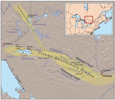
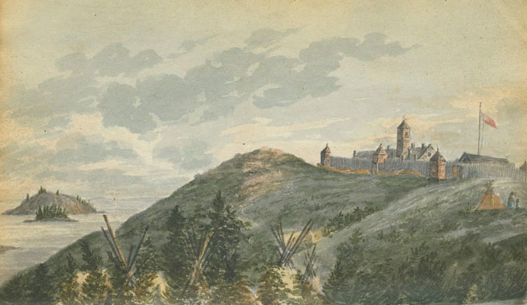
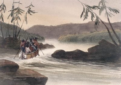
Memorialized between the 1830s and 1860s in the paintings of Frances Hopkins, Paul Kane, William Bartlett, Philip Bainbridge, and others, the fur trade’s main route west from Montreal had no connection with Upper Canada and no reason to engage with it. The western route followed the natural chasm of the Ottawa River, which acted as a giant canal (known by some as “the first Trans-Canada Highway”) through the Canadian Shield and formed the NWC’s main transport and supply route to the Interior. The Ottawa River followed a lucky geological aberration, technically the Ottawa-Bonnechere Graben, a topographic depression that runs from Montreal to Lake Nipissing — a channel through the otherwise unyielding Canadian Shield and a natural thoroughfare for river-borne traffic to Michipicoten and Fort William. In short, until 1821 the expansionist Montreal fur trade passed hundreds of miles to the north of the sedentary and lake-locked farming settlements of the Great Western Peninsula.
After 1821, the newly organized HBC shifted its focus from the NWC’s headquarters at Montreal to its bayside depots on Hudson Bay for strategic and economic reasons.[59] Montreal was 1,000 miles further east than the ocean access of Hudson Bay, a location that had given the HBC a spatial advantage in overland transport over the NWC and hastened the merger of 1821. After the merger, the HBC exported most of its pelts and other commodities directly to London from bayside posts, not from Montreal. After the merger, fur shipments from Montreal to London declined drastically as the new HBC oriented itself to Hudson Bay, and only a small percentage of the HBC’s furs were shipped to London via Montreal.[60] “For the next sixty years,” Wayne Moodie et al. observe with considerable understatement, with regard to the 1821 merger, “the economic development of the Western Interior and the Canadas followed separate courses.”[61] A map of the fur trade districts in 1870 shows no connection to Montreal at all, let alone to southern Ontario.[62] Only a massive investment in the CPR in the 1880s would re-establish, for the new post-confederation Canada, the pre-1821 east-west connection of the fur trade, a point made many years ago by Harold Innis, who wrote that the North West Company was “the forerunner of present-day confederation.”[63]
Simpson sought to isolate such frontiers from the main business of the HBC in the continental interior, though he kept the Ottawa River as a minor route, and even as a scenic route for European tourists, travellers, artists, hunters, and expeditions for direct access to Red River and Rupert’s Land. Simpson himself, from his Montreal Department headquarters at Lachine — where he kept a museum of Indigenous artifacts and travellers’ paintings — used the Ottawa River route as a means to access the main fur trade regions on his occasional tours.[67]
The coalition of 1821 resulted in the HBC’s near-monopoly control over much of its territory held by charter and licence, a territory that was coterminous with much of what is now Canada. The coalition meant an end to destructive competition between the London and Montreal-based fur trades and a high degree of corporate and financial stability in the absence of that competition.[68] Upper Canada was absent in this stirring history. It had no connection to Rupert’s Land. Nothing linked Upper Canada to the territories of the HBC in the nineteenth century apart from a mutual cartographic presence within what was styled British North America: no tradition of hiring personnel, no commercial connection, no movement of people, no technology, no trade, no foodstuffs, no provision supplies, and only a single token and declining transport route on its northern boundary, the Ottawa River.
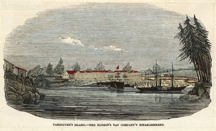
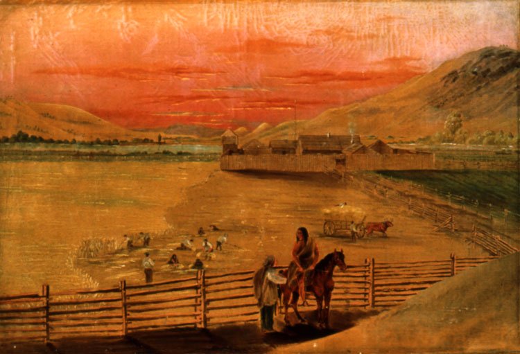
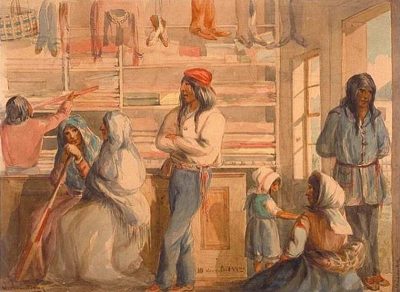
Fur traders’ retirement patterns emphasize the lack of commercial and demographic connection with southern Ontario. Northwesters David Thompson and Simon Fraser settled in Upper Canada, but when HBC employees retired following the merger of 1821, they tended to move — in their thousands — to the HBC’s colony at Red River, established in 1811. A much smaller fur trade retirement destination was a rural area around Aberdeen in Scotland. [69] After 1849, at least 200 retired to the colony of Vancouver Island.[70] The only HBC employees to choose Upper Canada as a retirement destination were about twenty men with fur trade families who settled in a cluster in the St. Thomas area, near the north shore of Lake Erie on the Great Western Peninsula. According to a recent scholar, Krista Barclay, these families and their descendants were “absorbed” into Ontario settler society. Little trace of them survived, and there is no trace of Métis identity in “old Ontario.”[71]
This separation would start to erode in the 1850s and 1860s. Historian Douglas Owram places the beginning of the Upper Canadian expansionist movement at 1856. Once its agricultural frontier had reached the Canadian Shield and the eastern shore of Lake Huron, and once its land sales entered a sharp decline, Upper Canada started to gaze further west for more agricultural land. In the process, Ontario politicians adopted the language and sentiments of American expansionists, with George Brown, editor of the Toronto Globe, even referring, bizarrely but tellingly, to the HBC territories as Ontario’s “birth right.”[72]
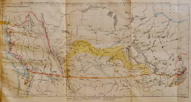

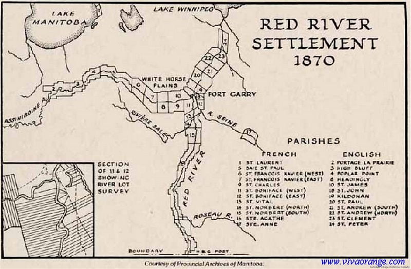
This expansionist impulse produced the only tangible connection between Upper Canada and Rupert’s Land before 1869, the Hind Expedition, formally known as the Canadian Red River, Assiniboine and Saskatchewan Exploring Expedition of 1857-58, led by Henry Hind, a Toronto geologist and naturalist. Its aim, according to Gerald Heinrichs, was to find “a reliable route from Lake Superior to the Red River Settlement, and then to inspect the potential of the land west of Red River for its fitness for future settlement.” Its purpose was similar to a British expedition into Rupert’s Land led by John Palliser from 1857-60. Both Hind and Palliser reported on what became known as the “Fertile Belt,” an extensive arc of land stretching from Red River to the Rocky Mountains, and containing (according to Hind) 40 million acres of farmland. Ominously, Hind wrote that this fertile land would be useless until the arrival of “an energetic race, able to improve on its vast capabilities and appreciate its marvellous beauties” (p. 72). Hind did not put Indigenous people, Métis people, or French Canadians in the category of “energetic race.” He imagined Rupert’s Land as “a slate to clean” in which Métis and Indigenous people were a potential labour pool rather than proprietors of the soil.[73]
The transient Palliser and Hind expeditions left little behind but maps and names on maps. Hind accurately anticipated the farming potential of the southern portions of Rupert’s Land,[74] but his expedition left no presence or personnel there. Despite the visit of Hind and his colleagues, Upper Canada had no political, demographic, or economic connection with Rupert’s Land – no past there, no mythology, no precedent, no western consciousness. Upper Canada had its own western peninsula, its own founding myths, its own literature of genesis in a fertile, peninsular, lacustrine heartland.
Upper Canada, and by extension the history and historiography of southern Ontario, was far removed from the most important developments in the fur trade — and the construction of the modern map of Canada — in the nineteenth century: the NWC’s expansion to the Pacific in the 1790s; its extension of operations to the Mackenzie, Yukon, Columbia, and Fraser rivers and their major tributaries; conflict between the NWC and HBC with American fur and general trading companies west of the Rockies; the many aspects of the HBC’s consolidation of the continental fur trade after 1821; the HBC’s commercial strategies, for example “species mix (diversification) and fur conservation; the HBC’s development of provision strategies, from pemmican to wild rice, sturgeon, and Pacific salmon; the HBC’s major and successful attempts at economic diversification (farming, fishing, logging, and mining) on the resource-rich and ice-free Pacific coast, including the HBC’s first ventures into the retail trade; a reliance across the continent on Indigenous trade, labour, material culture, and Indigenous knowledge, including maps; the provisions for “country marriages” and their ubiquity; Simpson’s removal of “surplus personnel” and their families to Red River after 1821; the assistance and encouragement given to visiting artists in the mid nineteenth century including Paul Kane, Henry Warre, William Hind, Frances Hopkins, and Philip Bainbridge — these and many other staple topics of fur trade, western Canadian, and British Columbia scholarship were played out in complete isolation from Upper Canada’s heartland of settlement on the Great Western Peninsula. The engrossing (and intensely Eurocentric) series of maps by Richard Ruggles, showing “unknown,” “partially known,” and “essentially known” regions within British North America in 1650, 1700, 1750, 1800, and 1870, owed little to exploration from Upper Canada, which was hemmed in by the Great Lakes and the Canadian Shield, and much to to the twin overland motors of the NWC and HBC and to the surveys by the Royal Navy of the Arctic and Pacific coastlines and islands.

*
All these topics have generated considerable secondary literatures that deserve to be included in textbooks of pre-confederation Canadian history. In part, a scholarly “disconnect” based on regional histories and identities is at work. The topical separation between Ontario and fur trade history produced an intellectual chasm between the concerns of a politically mature heartland of settlement in southern Ontario, and the concerns, for example, of Métis and Indigenous identity that arose during two centuries of corporate activity west of the Great Lakes and, at Red River, colonial settlement. Resistance to the imposition of an unsympathetic, unfamiliar, and racist settler society was the whole point of Riel’s actions in 1869-70.
Under George Simpson, the HBC put in place the elements of a cohesive continental economy between 1821 and 1860, decades before the Canadian federation had the same idea with the National Policy of John A. Macdonald. The framework of a transcontinental commercial entity was devised by the NWC in the 1790s when, following Alexander Mackenzie’s voyages, the idea of a North West Passage by land emerged and then flourished. Indeed, a de facto commercial federation with far-reaching demographic and social implications was put in place in the Simpson era. This idea, as the fur traders conceived it, consisted of a continental economy based on the east-west transport routes of the fur trade, such as the York Factory Express, a structure that worked in isolation from Canadian or American Canadian settlements to the south. The plan also contained a blueprint for a Pacific economy — that is, for a viable trade link between the Columbia Department depot and Pacific markets.[75] On land, the model relied on a riverine transport route that extended across Rupert’s Land and into the western cordillera to the headwaters of the Columbia and Fraser – rivers that, ultimately, ran east to west from their origins near the Rockies to the Pacific. Only the fur traders had the commercial strategies, experienced personnel, and financial and managerial acumen to embrace half a continent in this fashion and then extend their trade to Pacific markets.[76]
George Simpson — “The Little Emperor,” “The Emperor of the North” — was perhaps the most powerful and significant figure in British North America in the three decades before his death in 1860.[77] Previously a sugar broker’s clerk in a London firm of West India merchants, Simpson joined the HBC in 1820 and was put in charge of the Athabasca District. A year later he took charge of the Northern Department and in 1826 was made governor of the HBC’s territories in North America. His contemporaries were well aware of his influence. “Sir George Simpson’s rule is more absolute than that of any governor under the British crown,” wrote his critic, the fur trader John McLean, in 1845; “his influence with the [Governor] and committee [in London] enables him to carry into effect any measure he may recommend.”[78]
The Simpson era is one of transcontinental expansion and corporate consolidation, not just of a hybrid of NWC and HBC commercial practices, but an extension of the territories, charters, licences, policies, personnel, and ambitions of both companies.[79] Simpson’s Chief Factors and Chief Traders and other officers including clerks were the effective regional managers of their fur trade districts, and from their ranks arose such powerful regional political and business figures as Donald Smith (later Lord Strathcona) of Labrador and Sir James Douglas of British Columbia.[80]
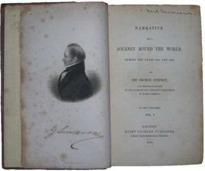
Simpson’s tours have no equal in the lives of public figures anywhere else in British North America. In a practical and spatial sense they were prime ministerial, and because the HBC’s districts ranged from the Atlantic to the Pacific, Simpson found it convenient on his third transcontinental tour, in 1841-42, to sail around the world. What Canadian politician of the first half of the 19th century could have conceived or written a book entitled Narrative of a Journey Round the World?[81]
No one knew British North America as well as Simpson. In 1843, he referred, in a private letter, to the company’s districts as extending “from the Atlantic to the Pacific — from the shores of Labrador to the Polar Sea.”[82] No politician in the Canadian colonies — or in the United States — could yet make such a territorial claim. Indeed, the transcontinental fact at the basis of Canadian nationhood ultimately owes more to the commercial policies and economies of the NWC and HBC between the 1780s and 1860s than to the political impulse that led to the confederation of 1867, which was a union of three established settler colonies (The United Province of Canada, Nova Scotia, and New Brunswick) in central and Atlantic Canada. Territorially, the most substantial and ambitious act of the confederation era was not the union of 1867, but Canada’s purchase of Rupert’s Land in 1869, followed by Canada’s union with British Columbia in 1871.
Simpson was on a first-name basis with the HBC’s officers and clerks, as evidenced in his infamous and deeply personal “character book.”[83] He corresponded with literate HBC personnel and knew the intimate details of life and commerce at posts between Hamilton Inlet in Labrador and Beaver Harbour on Vancouver Island, and his letters display an attention to detail, a micro-managing, an insistence on economic self-sufficiency (autarky), and a pervasive sense of thrift, economy, regularity, and commercial centralization. For example, the same English Spode Ware is found in archaeological excavations across the continent. Purchased in bulk in London, it was sent by the annual ships separately to all four depots, and Spode/ Copeland transfer-print China has been found at 20 Hudson’s Bay Company Sites.[84] Simpson’s control allowed him to impose a uniform corporate culture over a large area. The HBC’s legal code — its “Standing Rules and Regulations” — applied on a continental basis.[85] Simpson also imposed a uniform standard of the “Indian Trade” and a consistent “Indian Policy,” regulations that governed the HBC’s economic and diplomatic relations with Indigenous peoples.[86]
Yet little of this deep western history, of which this is only a quick outline, has found its way into the national narrative. The focus on the political events leading up to 1867, which saw a union between colonies on the St. Lawrence and Atlantic, minimizes the magnitude of the events of 1870 and 1871, when the former HBC regions Rupert’s Land and British Columbia joined the Canadian confederation and gave, in the process, the country the broad shape and boundaries that remain to this day. Indeed, the year 1871 — or even 1873, when Prince Edward Island joined — would make a far more natural and appropriate terminus a quo for pre-confederation Canadian history than 1867.
A full account of confederation must do more than fixate on the familiar tropes of homesteading and the local politics of the Great Western Peninsula, and recognize that confederation was a merger of two equal achievements, a joining of two areas of extraordinary significance in British North America between 1820 and 1870. The first, a vital political achievement, consisted of a struggle for responsible government in Upper and Lower Canada and the emergence of a federalist impulse, framework, and template. The Act of Union of 1841 was a central and essential event. The second was the commercial achievement of the HBC between 1821 and the 1860s, when the broad physical outlines of modern Canada first appeared on maps in the form of the HBC’s four major departments — one of which, the Columbia, gave its name directly to British Columbia in 1858.[87] These two visions of Canada are both competing and complementary: a Laurentian settlement genesis and a fur trade genesis. The first was based, ultimately, on the agricultural and settlement frontiers of Lower and Upper Canada: in the achievement of the seigneurial system of New France in the eighteenth century and the filling in of the Great Western Peninsula in the nineteenth. The second vision of Canada emerged from the HBC’s extension and consolidation into four large and autonomous departments that covered half a continent. Just as the HBC merged with the NWC in 1821, so the HBC merged with Canada in 1870.
The central narrative of 19th century Canadian history assumes the absorption of most of British North America by an expansionist central Canadian state. And to some extent such a political understanding is legitimate, especially as Canadian government institutions, from the post office to Indian Agencies and Geological Survey of Canada, were now compelled to expand and operate across a new continental Canada. But confederation, and Ontario’s subsequent expansion to the west and north, was primarily a top-down political act, not one based on rooted demographic or economic processes.[88]
Politically, Canada extended its administration to absorb the HBC districts, but spatially and emotionally and to a large extent historically, most of northern and western Canada has roots — and DNA — in the fur trade, not in Upper Canada. Canada took over the land and politics of Rupert’s Land in 1870, but in demographic terms the territories managed by the HBC now constitute much of Canada, and the deep history of the west and north of the country goes back to the people, districts, and economies of the fur trade — not to the settler-colonial populations and farms of a distant southern peninsula. Personnel and families from the fur trade era did not simply evaporate when Rupert’s Land and British Columbia became Canadian. An example of the grafting of older fur trade network onto newly-arrived Canadian federal institutions is the dominance of former HBC employees – none of them with Canadian connections — as Indian Agents in the Prairie West and British Columbia in the late 19th century.[89]

The national political narrative in introductory Canadian history textbooks should be qualified and enriched with a greater emphasis on the separate origins and autonomy of the Canadian regions. This will give elbowroom to the deep regional histories of Canada and compensate for the centralist and political focus of those undergraduate textbooks that simplistically charted the extension of the name “Canada” to the rest of British North America. Moreover, the writing on pre-1870 Rupert’s Land and pre-1871 British Columbia provides deep and legitimate regional scholarly traditions that professional historians elsewhere in Canada should take the trouble to learn. Historians and genealogists in most of the west and north discover repeatedly what Louis Riel knew: that Upper Canada’s westward expansion provided only a thin and recent veneer detached from deeper, older, and local institutional structures and family histories of the fur trade. The purchase of Rupert’s Land did not provide Upper Canada with a colony, a clean slate, an empty west, a tabula rasa of new territory. The social and demographic influence of the fur trade has never gone away, and indeed both Ontario and Quebec, by appropriating large sections of Rupert’s Land, have also inherited their own extensive northern and western fur trade histories that now extend not just to Métis people but to the Indigenous communities and societies of the fur trade era.[90]
Much of western and northern Canada has roots in the fur trade, not in southern Ontario. Regional and local historians and genealogists between Labrador and Vancouver Island trace stories, families, and genealogies back to the regional economies, employees, and families of a fur trade that predated confederation.[91] Given the reach and depth of these histories and family ties, it might be time to look beyond central Canadian political and settlement history to embrace a large and rich history.
Meanwhile, the textbook that so exercised me 25 years ago is still in print. Origins: Canadian History to Confederation, has a photo of a Prairie wagon on its cover. Then in its 3rd edition, it is now in its 8th. Co-authored now by Robert Wardhaugh, Alan MacEachern, R. Douglas Francis, Richard Jones, and Donald B. Smith, the book’s basic structure remains the same. Only two of its 21 chapters concern the 19th century fur trade territories and settlements and the three colonies that grew out of them: Chapter 19, “The Northwest,” and Chapter 20, “The Pacific Coast.” I feel sorry for those sessional lecturers.
*

Richard Somerset Mackie started The Ormsby Review with Alan Twigg in September 2016, after working for six years at the journal BC Studies as associate editor and book reviews editor. He has an Honours M.A. in mediaeval and modern history from the University of St. Andrews, Scotland. He lives in East Vancouver.
*
Endnotes:
[1] I presented an earlier version of this essay at the Western Canadian Studies conference, University of Manitoba, November 2015. I thank Graeme Wynn for supporting my leave from BC Studies, where I was then associate editor and book reviews editor, and Adele Perry and Peter Ives for putting me up in Winnipeg. For their discussions in Winnipeg or later I thank Krista Barclay, Ben Bradley, Robert Coutts, Ryan Eyford, Kurt Korneski, Greg Stott, and Nikki Strong-Boag. Susan Safyan has supported my endeavours. I thank my students from my career as a sessional lecturer in history and historical geography (1992-2017) at the University of Victoria, North Island College, Malaspina University-College, and the University of British Columbia. I also taught Canadian history at the University of Washington, Seattle, as McClelland Lecturer in Pacific Northwest History, 1996–97. The ideas presented here in no way reflect those of anyone involved with it.
[2] Richard Somerset Mackie, Trading Beyond the Mountains: The British Fur Trade on the Pacific, 1793-1843 (Vancouver: UBC Press, 1997). The DCB biographies were of George Blenkinsop, William Charles, James Grahame, Joseph McKay, Benjamin Pearse, and Joseph Pemberton.
[3] For four of my five pre-confed courses I was assigned the 3rd or 4th editions of Origins: Canadian History to Confederation. Only two of the twenty chapters concerned the area west of Ontario: Chapter 18 (“The Northwest to the 1860s”) and Chapter 19, “The Pacific Coast to the 1860s”). See R. Douglas Francis and Donald B. Smith, Origins: Canadian History to Confederation. Third edition (Toronto: Harcourt Brace, 1996).
[4] According to bissett, “what brout me 2 ontario eye call Centralia was being writr in residens at western u.” https://canpoetry.library.utoronto.ca/canpoetry/bissett/index.htm I owe this reference to George Bowering.
[5] Alexander Ross, The Fur Hunters of the Far West; A Narrative of Adventures in the Oregon and Rocky Mountains (London: Smith, Elder, and Company, 1855), Volume 2, p. 230.
[6] Historical geographer Robert Galois was the sole or principal author of four of those six BC plates; he was also a secondary author of a fifth plate. Volume I: plates 13 and 66; Volume II, plates 19 and 36; Volume III, plates 21 and 22.
[7] Wilson Duff, “The Fort Victoria Treaties,” BC Studies 3 (Autumn 1969), pp. 3-57. For the Selkirk Treaty, see here.
[8] For the mission at Sainte-Marie-au-pays-des-Hurons, see HAC I, plate 34; for Forts Rouillé and Frontenac, see HAC I, plate 42. What is now the province of Ontario was known as the colony of Upper Canada from 1791 to 1841. From 1841-1867 it was Canada West, part of the United Province of Canada, a British colony. In 1867 it took the name Ontario. For convenience I refer to it in this essay as Upper Canada or Ontario.
[9] This paragraph is based largely on the first two volumes of the Historical Atlas of Canada, published in 1987 and 1993, and Cole Harris’s The Reluctant Land, published in 2008. R. Cole Harris, editor, Historical Atlas of Canada: Volume I: From the Beginning to 1800 (Toronto: University of Toronto Press, 1987) (hereafter HAC I); R. Louis Gentlicore, editor, Historical Atlas of Canada: Volume II: The Land Transformed, 1800-1891 (Toronto: University of Toronto Press, 1993) (hereafter HAC II). Cole Harris, The Reluctant Land: Society, Space, and Environment in Canada Before Confederation (UBC Press, 2008).
[10] “The Loyalists,” HAC II, plate 7.
[11] Cole Harris, “Canada in 1800,” HAC I, p. 171.
[12] See “Reserves of Eastern Canada to 1900” and “Southern Ontario Treaties,” HAC II, plate 32.
[13] David William Smyth, “A map of the province of Upper Canada describing all the new settlements, towns, townships, &c. with the countries adjacent, from Quebec to Lake Huron Compiled, at the Request of His Excellency Major General John G. Simcoe, First Lieutenant Governor by David William Smyth Esqr Surveyor General. London, Published by W. Faden, Geographer to His Majesty and to H.R.H. Prince of Wales. Charing Cross, April 12th 1800.” Accessed at http://yorkspace.library.yorku.ca/xmlui/handle/10315/20542
[14] See Cole Harris, “Canada in 1800,” HAC I, p. 172.
[15] “Ecological Regions, ca. AD 150,” HAC I, plates 17 and 17A.
[16] J. E. Gillespie and N. R. Richards, The Soil Survey of Victoria County, Report No. 25 of the Ontario Soil Survey (Guelph: Ontario Agricultural College, 1957), p. 41.
[17] “In western Quebec (later Upper Canada) allotments of land were identified and transferred as parts of townships,” note Gentlicore et al. “The first township survey, Number 1 at Cataraqui (Kingston) initiated a system which would spread throughout the province as a basis for the granting and occupancy of land. The survey and plan of this township, completed 27 Oct 1783, began with a row of 25 lots, each 120 acres, along the base line. Behind them, other rows of lots (concessions) would follow.” “The Coming of the Loyalists,” HAC II, plate 7.
[18] The 1785-1824 figures are from Jean-Claude Robert, “An Immigrant Population,” in HAC II, p. 21.
[19] Joan Winearls, Mapping Upper Canada, 1780-1867: An Annotated Bibliography of Manuscript and Printed Maps (Toronto: University of Toronto Press, 1991), xxii. For this map, see also Olsen, “Aspects of the Mapping of Southern Ontario,” 214; Hayes, Historical Atlas of Canada, map 281.
[20] James Chewett and Thomas Ridout, A Map of the Province of Upper Canada and the Adjacent Territories in North America … Shewing the Districts, Counties and Townships in which are situated the Lands purchased from the Crown by The Canada Company (London: C. Smith & Son, 1826). See https://www.raremaps.com/gallery/enlarge/37571
[21] On the Ontario wheat economy see Brian S. Osborne, “Expanding Economies,” HAC II, 34.
[22] For the map of 1842, see J. David Wood, “A New Agriculture — Upper Canada to 1851,” HAC II, plate 14; for Richardson’s work see HAC II, plate 3.
[23] Wood, “A New Agriculture — Upper Canada to 1851,” HAC II, plate 14.
[24] See, for example, John McCallum, Unequal Beginnings: Agriculture and Economic Development in Quebec and Ontario until 1870 (University of Toronto Press, 1980).
[25] Louis Gentlicore, “Canada in the Nineteenth Century,” HAC II, p. 5.
[26] Gillespie and Richards, The Soil Survey of Victoria County (1957), p. 41.
[27] Wood, “A New Agriculture — Upper Canada to 1851,” HAC II, plate 14.
[28] Herman Merivale, Lectures on Colonization and Colonies (London: Longman, Brown, Green, and Longmans, 1842) (Volume 2), p. 96.
[29] Wood, “A New Agriculture — Upper Canada to 1851,” HAC II, plate 14.
[30] Canada, Commission for Crown Lands, Report of the Commissioner of Crown Lands of Canada for the Year 1856 (Toronto: Queen’s Printer, 1857), 6. The term “western peninsula” is still in use among historians of Ontario. See Lucille H. Campey, “The Attractions of the Western Peninsula,” ch. 8 of The Scottish Pioneers of Upper Canada, 1784-1855: Glengarry and Beyond (Toronto: Natural Heritage Books, 2005), 127-151.
[31] Wood, “A New Agriculture: Upper Canada to 1851,” HAC II, plate 14.
[32] “Population in the Canadas and the Maritimes to 1851,” HAC II, plate 10.
[33] “Beginning in the 1790s wheat and flour were shipped from the province via the St. Lawrence River to Britain. Exports increased after 1820, rising dramatically in the 1840s; at the same time shipments increased to Quebec and the Maritimes.” Wood, “A New Agriculture: Upper Canada to 1851,” HAC II, plate 14. Douglas McCalla, by contrast, argues that most wheat “produced in Upper Canada was consumed there and that which was destined down river was often mainly for consumption in Lower Canada. Thus wheat was not predominately an export staple.” See Bruce Wilson’s review in Archivaria 39 (Spring 1995) of McCalla, Planting the Province: The Economic History of Upper Canada, 1784-1870 (Toronto: University of Toronto Press, 1993).
[34] “By Hand and Water: Manufacturing to 1851,” HAC II, plate 16.
[35] A. Brian McKillop, “Laurentian Thesis,” The Canadian Encyclopedia http://www.thecanadianencyclopedia.ca/en/article/laurentian-thesis/
[36] C. Grant Head, “Economies in Transition,” HAC II, p. 97.
[37] Harris, The Reluctant Land, p. xv and passim in preface.
[38] Cole Harris, “Canada in 1800,” HAC I, p. 172.
[39] See “Timber Production and Trade to 1850,” HAC II, plate 11, and “The Forest Industry,” HAC II, plate 38.
[40] For a recent survey of the Laurentian thesis, see Daniel Macfarlane, Negotiating a River: Canada, the US, and the Creation of the St. Lawrence Seaway (Vancouver: UBC Press, 2014).
[41] The European settlements of early Canada, Harris writes, comprised “an island archipelago spread over 4000 east-west miles. Different islands were settled at different times within different technologies and economies by people from different backgrounds.” Cole Harris, “Regionalism and the Canadian Archipelago,” in Larry McCann & Angus Gunn (eds) Heartland Hinterland: A Regional Geography of Canada (Toronto: Prentice-Hall, 1998), pp. 395-421.
[42] “Emergence of a Transportation System, 1837-1852,” HAC II, plate 25.
[43] “W.C. Chewett & Co., Toronto, Map of Canada West, Engraved & Published in the Canadian Almanack for 1865….,” McMaster University Library, Research Collections.
[44] “Linking Canada, 1867-1891,” HAC II, plate 27.
[45] See for example “The Canadian Population 1871, 1891,” HAC II, plate 29.
[46] “Linking Canada, 1867-1891,” HAC II, plate 27.
[47] For example, http://www.archives.gov.on.ca/en/maps/textdocs/ontario-districts-maps.aspx#districts_1788
[48] By comparison, the far newer colony of British Columbia, between 1861 and 1865, built the Cariboo Wagon Road some 400 miles (644 km) through challenging terrain. See Ramona Boyle and Richard Mackie, “The Hudson’s Bay Company in Barkerville,” BC Studies 185 (Spring 2015), pp. 79-107 (p. 80).
[49] Dan Francis, A Road for Canada: The Illustrated Story of the Trans-Canada Highway (North Vancouver: Stanton Atkins & Dosil, p. 59.
[50] “Politics and Parties, 1867-1896,” HAC II, plate 28.
[51] Between 1850 and 1870, some 170,000 French Canadians moved to factory towns in New England. Harris, The Reluctant Land, 299. This was a problem for the elites. See also Jean-Claude Robert, “The Immigrant Population,” HAC II. See also “The Exodus: Migrations, 1860-1900,” HAC II, Plate 31.
[52] HAC II, plate 31.
[53] See Mackie, Trading Beyond the Mountains, pp. 111-112, 121 and chapter 5, based on E. E. Rich and A. M. Johnson, eds., Peter Skene Ogden’s Snake Country Journals, 1824-25 and 1825-26; K.G. Davies, ed., Peter Skene Ogden’s Snake Country Journal 1826-1827; Glyndwr Williams and David E. Miller, eds., Peter Skene Ogden’s Snake Country Journals, 1827-29 (London: Hudson’s Bay Record Society, 1950, 1961, 1971) (Volumes 13, 23, 28).
[54] My estimate for total square miles in 1830 does not include what is now the American Pacific Northwest, where the HBC operated from 1821 until 1846.
[55] See Hudson’s Bay Company, Charters, Statutes, Orders in Council, etc., Relating to the Hudson’s Bay Company (London: Hudson’s Bay Company, 1960).
[56] For a book that can best be read as an extended analysis of the commercial strategies of the fur trade, see Harold Innis, The Fur Trade in Canada: An Introduction to Canadian Economic History (1930). For a summary of those strategies, see Mackie, Trading Beyond the Mountains, pp. 39-43.
[57] The most important work in this regard is Nicole St-Onge’s “Tracing the Voyageur” meta-database that brings together notarized fur trade contracts signed in the Montréal-Trois-Rivières (Québec) corridor between 1755 and 1870. See also Robert Englebert and Nicole St-Onge, “Paddling into History: French-Canadian Voyageurs and the Creation of a Fur Trade World, 1730-1804,” in Denis Combet, Luc Côté and Gilles Lesage, eds., De Pierre-Esprit Radisson à Louis Riel: voyageurs et Métis/ From Pierre-Esprit Radisson to Louis Riel (Winnipeg: Presses universitaires de Saint-Boniface, 2013), pp. 71-104. On the HBC’s continued hiring in the St. Lawrence seigneuries, see also Allan Greer, Peasant, Lord, and Merchant: Rural Society in Three Quebec Parishes, 1740-1840 (Toronto: University of Toronto Press, 1985). See also Jean Barman, French Canadians, Furs, and Indigenous Women in the Making of the Pacific Northwest (Vancouver: UBC Press, 2014) and Jean Barman, Iroquois in the West (Montreal and Kingston: McGill-Queens University Press, 2019).
[58] In 1800, Sault Ste Marie, at the eastern end of Lake Superior, was the only important fur trade post on the north shore of the Great Lakes. “Trading Posts 1774-1821,” HAC I, plate 62. See also “Eastern Canada in 1800,” HAC I, plate 68.
[59] On Simpson’s important realignment of the HBC’s trade from Montreal to Hudson Bay after 1821 see H.A. Innis, introduction to R. Harvey Fleming, ed., Minutes of the Northern Department of Rupert’s Land, 1821-31 (London: Hudson’s Bay Record Society, 1940), p. lvi.
[60] See “Reorganization of the Trade after 1821” and “London Beaver returns 1817-1824,”HAC I, plate 61. These furs shipped from Montreal were from the HBC’s Lake Superior and Abitibi fur trade districts.
[61] “Competition and Consolidation, 1760-1825,” HAC I, plate 61.
[62] This separation meant a gradual decline in the number of French Canadians actively engaged in the fur trade, e.g. in the Northern Department from 160 in 1830 to 10 in 1880. “The Fur Trade Northwest to 1870,” HAC II, plate 17.
[63] Innis, The Fur Trade in Canada, p. 392. “Canada’s east-west political orientation was determined specifically by the canoe-routes established by fur traders.” See also Harold A. Innis, A History of the Canadian Pacific Railway (Toronto: McClelland and Stewart, 1923).
[64] Galbraith defined a frontier in the fur trade as “the line where the area of monopoly touched the area of competition.” John S. Galbraith, The Hudson’s Bay Company as an Imperial Factor (Toronto: University of Toronto Press, 1957), p. 10.
[65] The Sayer Trial of 1849 was a setback to Simpson and the HBC). See W. L. Morton, “SAYER, PIERRE-GUILLAUME,” in Dictionary of Canadian Biography, vol. 7, University of Toronto/Université Laval, 2003–, accessed January 19, 2020, http://www.biographi.ca/en/bio/sayer_pierre_guillaume_7E.html.
[66] For the Snake Party, see Mackie, Trading Beyond the Mountains, chapter 5.
[67] See, for example, Sir George Simpson, An Overland Journey Round the World, During the Years 1841 and 1842 2 Vols (London: H. Colbourn, 1847). See also Susan Stewart, “Sir George Simpson: Collector,” The Beaver (Summer 1982), pp. 4-9.
[68] “The Fur Trade Northwest to 1870,” HAC II, plate 17.
[69] Lewis G. Thomas, “Fur Traders in Retirement,” The Beaver 310: 3 (Winter 1979), pp. 14-21. In 1799, Northwester David Thompson married Charlotte Small, the Metis daughter of a colleague in the North West Company, at Île-à-la-Crosse, and in 1815 settled at Williamstown, Upper Canada. See John Nicks, “THOMPSON, DAVID (1770-1857),” in Dictionary of Canadian Biography, vol. 8, University of Toronto/Université Laval, 2003–, accessed February 17, 2020, http://www.biographi.ca/en/bio/thompson_david_1770_1857_8E.html. In 1820, Northwester Simon Fraser (1776-1862) settled near present-day Cornwall, Upper Canada, and married into a local, not a fur trade family. See W. Kaye Lamb, “FRASER, SIMON,” in Dictionary of Canadian Biography, vol. 9, University of Toronto/Université Laval, 2003–, accessed February 17, 2020, http://www.biographi.ca/en/bio/fraser_simon_9E.html.
[70] See Richard Mackie, “The Colonization of Vancouver Island, 1849-1858,” BC Studies 96 (Winter 1992-93), pp. 1-40
[71] See Krista Barclay, “Life After the West: Hudson’s Bay Company Families in the 19th Century Imperial World,” paper presented at the Western Canadian Studies conference, University of Manitoba, 6 November 2015; personal communication, Krista Barclay, 6 November 2015. See also Krista Barclay, “‘Far asunder there are those to whom my name is music’: Nineteenth-century Hudson’s Bay Company families in the British imperial world” (PhD dissertation, University of Manitoba, 2019), available here. Two other former HBC men settled in Upper Canada, John McLean and William Kennedy, prominent critics of the company, but both eventually settled in Rupert’s Land or B.C. After 1846, Kennedy lived at Southampton and Toronto before settling permanently at Red River in 1860; McLean settled at Guelph and Elora before moving to Victoria in 1883. See Garron Wells, “McLEAN, JOHN (d. 1890),” in Dictionary of Canadian Biography, vol. 11, University of Toronto/Université Laval, 2003–, accessed February 19, 2020, http://www.biographi.ca/en/bio/mclean_john_1890_11E.html. and Edward Charles Shaw, “KENNEDY, WILLIAM,” in Dictionary of Canadian Biography, vol. 11, University of Toronto/Université Laval, 2003–, accessed February 19, 2020, http://www.biographi.ca/en/bio/kennedy_william_11E.html.
[72] I find Owram’s early analysis somewhat disingenuous and misleading. In Chapter 1, he appropriates British literatures, opinions, and authorities that had little to do with Upper Canada, leaving the reader to assume a greater Upper Canadian presence, opinion, and interest in Rupert’s Land than actually existed. He reaches firmer ground in Chapter 2 with his analysis of the origins of expansionism in the late 1840s and 1850s, when a political campaign against the HBC led by three ex-fur trade officers based in Britain and Canada — Alexander Isbister, John McLean, and William Kennedy – merged with a larger British parliamentary debate on whether to permit the HBC to colonize Vancouver Island, and then spilled over into Canadian politics. The HBC’s critics in Britain and Canada – and in the United States, for that matter – saw the company as a soulless profit-obsessed commercial entity (the grasping monopoly trope) with no proper Christian or humanitarian interest in Indigenous people. While the growing clamour for Rupert’s Land after 1856 (documented by Owram) appealed to central Canadian politicians, it was not based on any social, cultural, or demographic connection with the territory they desired. The campaign led by Brown and the Globe was political, expansionist, and based on a growing awareness that the Great Western Peninsula was full; land sales in Upper Canada slowed drastically in the 1850s. Ontario’s interest in the Northwest was, in a word, Imperial. See Douglas Owram, Promise of Eden: The Canadian Expansionist Movement and the Idea of the West, 1856-1900 (Toronto: University of Toronto Press, 1980), chapters 1 and 2.
[73] Hind is quoted by D.N. Sprague in his review of Owram, Promise of Eden, in Manitoba History 4 (1982). The quote comes from p. 72 of Owram. “Here in Henry Hind,” continues Sprague, “one finds a cultural bigotry which had plagued Canada since 1760 and was now about to be exported to a region where although not unknown, it was at least tolerably well under control.” Gerald Heinrichs is quoted in his “Palliser and Hind Expeditions,” http://esask.uregina.ca/entry/palliser_and_hind_expeditions.html. On the fertile belt, see R. Douglas Francis, “The Fertile Belt,” in the Encyclopedia of the Great Plains: http://plainshumanities.unl.edu/encyclopedia/doc/egp.ii.022 Associated with these visits was Simon James Dawson’s 1858 survey between Port Arthur and Red River of what would be known as the Dawson Road, built between 1868 and 1871. See here for a recent discussion of Palliser’s Triangle.
[74] “Exploration and Assessment to 1891,” HAC II, plate 3. See also Henry Youle Hind, Narrative of the Canadian Red River Exploring Expedition of 1857 and of the Assiniboine and Saskatchewan Exploring Expedition of 1858 2 volumes (London: 1860).
[75] See Nancy Anderson, The York Factory Express (Vancouver: Ronsdale Books, 2020). On the Pacific markets, see Mackie, Trading Beyond the Mountains, chapters 1, 3, 7, and 8.
[76] See the summary of the commercial strategies of the fur trade in Mackie, Trading Beyond the Mountains, pp. 39-43.
[77] James Raffan, Emperor Of The North: Sir George Simpson and the Remarkable Story of the Hudson’s Bay Company (Toronto: HarperCollins Canada, 2007)
[78] W.S. Wallace, ed., John McLean’s Notes of a Twenty-five Years’ Service in the Hudson’s Bay Territory (Toronto: Champlain Society, 1932), p. 25.
[79] See Hudson’s Bay Company, Charters, Statutes, Orders in Council, etc., Relating to the Hudson’s Bay Company (London: Hudson’s Bay Company, 1960).
[80] See Philip Goldring, “Governor Simpson’s Officers: Elite Recruitment in a British Overseas Enterprise, 1834-1870,” Prairie Forum 10: 2 (Fall 1985), pp. 251-81. The younger HBC employees of Simpson’s era went on to have important careers in Canadian politics, business, and government, most notably Donald Smith, but also coal mining magnate Robert Dunsmuir, politician Charles Ermatinger, officials in the early governments of Manitoba, including Premier John Norquay, and influential Indian Agents in BC including J.W. McKay, George Blenkinsop, A.C. Anderson, James Allan Grahame, and William Charles.
[81] Sir George Simpson, An Overland Journey Round the World, During the Years 1841 and 1842 (London: H. Colburn, 1847) (Two Volumes).
[82] Simpson to James Hargrave, 20 December 1843, Hargrave Papers, Library and Archives Canada.
[83] “The “Character Book’ of George Simpson, 1832,” in Glyndwr Williams, editor, Hudson’s Bay Miscellany 1670-1870 (Winnipeg: Hudson’s Bay Record Society, 1975), pp. 152-236.
[84] Lynne Sussman, Spode/Copeland Transfer-Printed Patterns Found at 20 Hudson’s Bay Company Sites, Canadian Historic Sites: Occasional Papers in Archaeology and History No. 22 (Ottawa: Minister of Supply and Services Canada, 1979); see also Douglas C. Wilson and Theresa E. Langford, eds., Exploring Fort Vancouver (Seattle: University of Washington Press, 2011).
[85] For the HBC’s “Standing Rules and Regulations” of 1835, see Douglas MacKay, The Honourable Company: A History of the Hudson’s Bay Company (London: Cassell and Company, 1937), pp. 391-409.
[86] See, for example, Barry M. Gough, “The Indian Policies of Great Britain and the United States in the Pacific Northwest in the mid-Nineteenth Century,” Canadian Journal of Native Studies 2:2 (1982), pp. 321-337.
[87] See Mackie, Trading Beyond the Mountains, p. 322.
[88] For the Geological Survey, see Suzanne Zeller, Inventing Canada: Early Victorian Science and the Idea of a Transcontinental Nation (University of Toronto Press, 1987). For Ontario’s expansion to the west and north, see http://www.archives.gov.on.ca/en/maps/ontario-boundaries.aspx#1791 BC history contains numerous studies of British settlers and settlements as well as studies of Finnish, Danish, Norwegian, Doukhobor, Kanaka, French Canadian, Iroquois, Chinese, and Japanese settlers and settlements, but I am unaware of a single study of an Ontarian community in BC, which strongly suggests a lack of large-scale group migration from Ontario to BC between 1886 and 1914. The Overlanders from Canada West did not form a single unified settlement but dispersed throughout the two colonies: see Mark Sweeten Wade, edited by John Hosie, The Overlanders of ’62 (Victoria: King’s Printer [C.F. Banfield], 1931); see also Richard Wright, Overlanders: The Epic Cross-Canada Treks for Gold, 1858-1862 (Saskatoon, Western Producer Prairie Books (1985; reprinted William Lake: Winter Quarters Press, 2000). The only study of a strongly Ontarian community I am aware of is Donna Cook, “Early Settlement in the Chilliwack Valley,” unpublished MA thesis, Department of Geography, University of British Columbia, 1979, which concerns Ontarian farmers who clustered around the CPR’s mainline in the Fraser Valley. It would seem that by the 1880s, when the CPR was completed, Ontario’s excess population had already gone south. See “The Exodus: Migrations, 1860-1900,” HAC Volume 2, plate 31.
[89] Fur trade officers A.C. Anderson, George Blenkinsop, Archibald McKinlay, J.W. McKay, William Charles, J.A. Grahame, and Hamilton Moffatt had notable careers as Indian Agents.
[90] Work has started on these. See Michel Bouchard, Sébastien Malette, Guillaume Marcotte, Bois-Brûlés: The Untold Story of the Métis of Western Québec (Vancouver: UBC Press, 2020).
[91] See, for example, Bruce McIntyre Watson, Lives Lived West of the Divide: A Biographical Dictionary of Fur Traders Working West of the Rockies, 1793-1858 (3 volumes) (Kelowna: University of British Columbia, Okanagan Campus. Centre for Social, Spatial, and Economic Justice, 2010). “I immigrated to Canada,” reflected writer Will Ferguson. “I didn’t grow up here. I grew up in the north which isn’t really Canada. That whole idea of stiff upper lip and reserve, that’s an Upper Canadian, UEL trait. Certainly the Quebecois, they don’t have a stiff upper lip; [and] BC has its own outlook on things. I grew up in the Footner Lake reserve area by Fort Vermillion [northern Alberta]. Canada was the country south of us where the radio and television signals came from. So I emigrated to Canada but didn’t feel like developing a stiff upper lip.” Will Ferguson quoted in Write, [newsletter of the Writers’ Union of Canada], February 2011, pp. 42-43.
*
The Ormsby Review. More Books. More Reviews. More Often.
Publisher and Editor: Richard Mackie
The Ormsby Review is a journal service for serious coverage of B.C. books and authors, hosted by Simon Fraser University. The Advisory Board consists of Jean Barman, Robin Fisher, Cole Harris, Wade Davis, Hugh Johnston, Patricia Roy, David Stouck, and Graeme Wynn. Scholarly Patron: SFU Graduate Liberal Studies. Honorary Patron: Yosef Wosk. Provincial Government Patron since September 2018: Creative BC
“Only connect.” – E.M. Forster
4 comments on “#742 Beyond the Great Western Peninsula”
Hello. Thank-you for this convincing essay on the distinct history of western Canada. I am researching my ancestry in the fur trade that links to most of the events and themes of your essay, from being United Empire Loyalists from the Mohawk Valley to Montreal, and onto the fur trade where they were chief traders, chief factors and explorers. Their families also ended up as some of the fur trade “surplus” relocated to Red River from the Columbia District. I am writing a fictionalized history of their travails. Your essay has consolidated a lot of information for me. Regards.
To all distressed, as I was, by this wonderfully-crafted reminder of Laurentian hubris … Harold Innis’s staple thesis continues to invigorate Canadian scholarship almost 90 years after the publication of his The Fur Trade in Canada (1930). And the observation about ordinary agency with which Innis concludes his Northwest Company chapter inspires to this day: “The Northwest Company was the forerunner of Confederation and it was built on the work of the French voyageur, the contributions of the Indian, especially the canoe, Indian corn, and pemmican, and the organizing ability of Anglo-American merchants.”