1278 Across the continent before GPS
The York Factory Express: Fort Vancouver to Hudson Bay, 1826-1849
by Nancy Marguerite Anderson
Vancouver: Ronsdale Books, 2021
$24.95 / 9781553805786
Reviewed by Walter Volovsek
*
 The York Factory Express was an enterprise for transporting Hudson’s Bay Company records, correspondence, and external mail along a water-based route that spanned the continent. This aquatic highway linked company headquarters at York Factory on Hudson Bay with Fort Vancouver, on the Columbia River some 100 river miles inland from the Pacific Ocean. Both of these ports were accessible by ships, but in the days before the Panama Canal, the express route provided faster service for papers of various sorts, which were protected in a carrying box that weighed around 70 lbs.
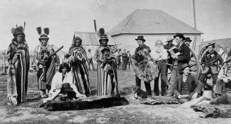
HBC workers who were retiring and heading out to “civilization” were part of the crew, as were others who were coming in to take up new positions or moving to different postings. Annual meetings at York Factory, Norway House, or Red River, where new developments were discussed, stories shared, and parties held were another reason for such long-distance travel.
Also taking advantage of the trans-continental runs were paying passengers, the so-called gentlemen. These were travellers on vast journeys, motivated by multiple reasons: priests seeking out new flocks for conversion; botanists like David Douglas in search of new discoveries; and settlers looking for greener pastures. The gentlemen expected to be treated as such, and not to partake in physical labour, unless it was helpful in relieving their boredom. This would become more noticeable as the trip dragged on.
The workers were referred to as men. Their main task was to propel the boats and to portage them and the gear where that became necessary. Most were Canadiens, with French being their spoken language. They preferred to be known as voyageurs, and they prided themselves on their prowess in working long days and carrying heavy loads.
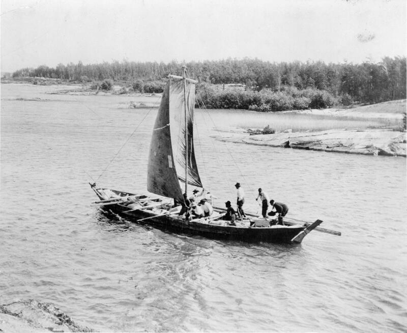
Their boats were variable. The York boats replaced the birch bark canoes by around 1835, as they were more sturdy and easier to repair. They were constructed of ¼ inch boards sealed along the joints with a compound made of pitch and tallow. But they were heavier on the portages. The loads on the express runs were normally much lighter than on the cargo service, and there was a lot of flexibility, so that birch bark canoes were still used where they could be easily repaired.
A somewhat unusual load of 3 live piglets and 3 calves was hauled in 1826 on the first outbound express, from Fort Vancouver to Spokane House (only visited by this express for this purpose, as it was well to the east of the Columbia), in order to provide breeding stock for Fort Colvile. Fort Colvile was being developed as an agricultural complex that provided crops like potatoes, turnips and grains for other HBC outposts. It was close to the river and nearby Kettle Falls provided plenty of salmon.
This rough outline provides a framework for discussing Nancy Anderson’s book, The York Factory Express: Fort Vancouver to Hudson Bay, 1826-1849. This commendable work is made admirable by its organization and attention to detail. In seventeen chapters we are taken on a journey from Fort Vancouver to York Factory, and then back again. The outgoing hundred-day journey commenced in late March so that Athabasca Pass was reached on still-firm spring snow; the return journey (called the Columbia Express) was made in time before the new winter snows blanketed the high mountain trails. This required the Columbia Express to head out in July so the Rocky Mountains were crossed and Boat Encampment on the Columbia River could be attained by October.
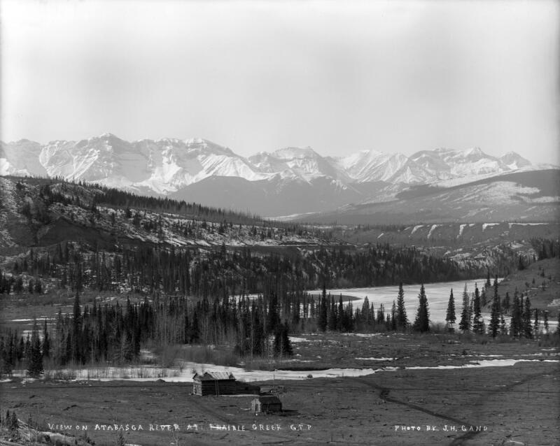
The longest leg of the 2,695-mile return journey was the 1,437 uphill miles to Edmonton House. As the author points out, “On every day of their journey they hauled their boats up an average height of 49 feet in order to reach the 3,232 foot elevation of Jasper’s House.” A further climb of 2,470 feet would see them at the watershed divide on Athabasca Pass, where – curiously — the waters empty from the Committee’s Punch Bowl pond into both watersheds.
The fascinating narrative is supported by excerpts from journals of six express leaders:
John McLeod in 1826
Edward Ermatinger in 1827 and 1828
George Traill Allan in 1841
James Douglas on three occasions
Thomas Lowe in 1847 and 1848
John Charles in 1849
Quotations from other sources further enrich the fascinating text.
The author skilfully interweaves extracts where various settings and their problems are described from different temporal perspectives. Exciting stories of encounters with Indigenous people and wild animals punctuate the text that otherwise would be somewhat blanched by the monotonous routine that we can easily imagine. Mosquitoes are mentioned only a couple of times, as the voyageurs prided themselves on ignoring the difficulties and pushing on past all obstacles without complaining.
*
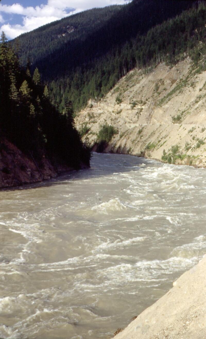
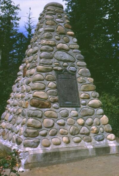
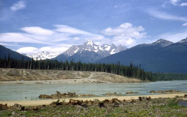
Living on the banks of the Columbia just upstream from its confluence with the Kootenay, I love reading these accounts of earlier travellers on the historic river, which was greatly altered during the1960s and later by dam construction. This leads to the only complaint I have about Nancy’s wonderful book: in places she discusses the long-flooded points of interest as though they were still accessible. I followed the Big Bend Highway prior to its flooding and took a nice picture of Steamboat Rapids. But these sites disappeared in 1984 behind Revelstoke Dam, whose reservoir nearly reaches Mica Dam. The stone monument commemorating Boat Encampment is now under 525 feet of water when the Mica Reservoir is full.
I have tried to share my enthusiasm for what I call River Stories by the development of interpretive sign panels along riverside trails locally. A wave motif, signifying the local rivers, forms part of the sign design. One of my earliest panels is called Whispers in the Wind; it deals with the earliest travellers on the Columbia River, and the ghosts they left behind. My website (www.trailsintime.org) provides some of those stories.
In The Epilogue, titled We Are Still Here, Nancy Anderson laments the bias exhibited by later immigrants towards the descendants of those who had pioneered and worked the routes across our nation. Sadly, they learned “to remain quiet and to allow ourselves to be absorbed into whichever community we felt most comfortable in.” Anderson’s book opens up a new window into that quiet retreat.
*
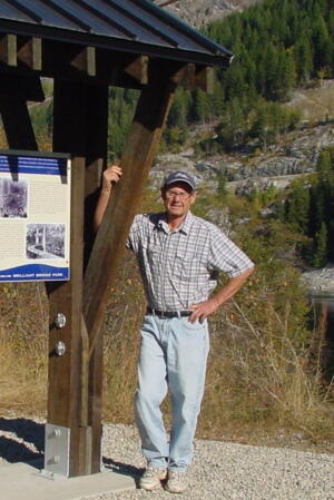
After managing the biology labs at Selkirk College for 24 years, Walter O. Volovsek retired to a second (voluntary) career: developing walking and ski touring trails for the Castlegar community. Most of these were developed to present to the user a pathway into the past by means of interpretive signage in the field, and related essays on his website. This endeavour led to connections with descendants of important Castlegar pioneers, such as Albert McCleary and Edward Mahon. In 2012 Walter self-published his biography of Castlegar founder Edward Mahon, The Green Necklace: The Vision Quest of Edward Mahon (Otmar Publishing, 2012). In addition to his plans for Castlegar, Mahon was also known for his legacy of parks and greenways in North Vancouver. Walter has also written a book on his trail-building efforts, Trails in Time: Reflections (Otmar, 2012), and has been commissioned to develop signs on local history in key locations, including Castlegar Millennium Park, Castlegar Spirit Square, and Brilliant Bridge Regional Park. Editor’s note: Walter Volovsek has also reviewed books by Michael Haynes, Derek Hayes, Paul Watson, Owen Beattie & John Geiger and Ralph Beaumont for The Ormsby Review.
*
The Ormsby Review. More Books. More Reviews. More Often.
Publisher and Editor: Richard Mackie
The Ormsby Review is a journal service for in-depth coverage of BC books and authors in all genres. The Advisory Board consists of Jean Barman, Wade Davis, Robin Fisher, Cole Harris, Hugh Johnston, Kathy Mezei, Patricia Roy, Maria Tippett, and Graeme Wynn. Scholarly Patron: SFU Graduate Liberal Studies. Honorary Patron: Yosef Wosk. Provincial Government Patron since September 2018: Creative BC
“Only connect.” – E.M. Forster


3 comments on “1278 Across the continent before GPS”